Flood Cell 10 North & South Aldeburgh
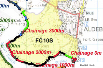
Click the image above to view/download the full Flood Cell 10S map
INTRODUCTION
Aldeburgh
Flood Cell 10 South has 209 hectares and lies on the southern side of Aldeburgh town fronting both the coast at Slaughden and the estuary. A flood cell with some areas of permanent and semi-permanent wet grassland (grazed by cattle and sheep) freshwater ditches, freshwater flight ponds and over 50% used as arable. There are 245 properties, and listed buildings overlooking the marsh and on the coast that are liable to flooding should the defences fail. The value of these (as valued in 2009) was in excess of £435M.
Thorpeness
409 hectares of FC10 North lies behind the shingle ridge that runs between Aldeburgh and Thorpeness. Most of this area is within the Leiston to Aldeburgh SSSI and contains a mosaic of permanent wet grassland with ephemeral water flashes, reedbed, fen, freshwater bodes, deciduous woodland and freshwater ditches, some of which are choked reed-filled. About 15% of the cell is arable. The eastern boundary runs along the coast and incorporates the vegetated shingled that is between Aldeburgh and Thorpeness. This part of the SSSI is notable for its plant life. The area includes a Site of Special Scientific Interest (SSSI) and Local Nature Reserve along the frontage. This flood cell does not fall at present within the responsibility of The Partnership.
…………………………………………………….
UPGRADE DESIGN PLAN
The map above and the upgrade design document below detail the work we need to do.
To Download the full plan, please click the link below
– Flood Cell 10 South Upgrade Designs
– Ordnance Survey Map showing full extent of Flood Cell 10 South