Flood Cell 9
INTRODUCTION
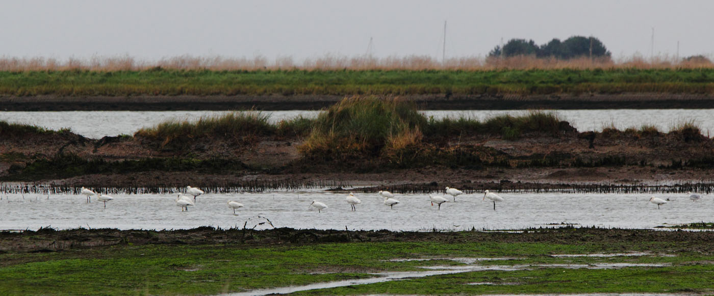
This cell lies on the north bank of the upper estuary just inland from Aldeburgh, between the estuary and the Saxmundham Road (A1094). The majority of cell is owned by Suffolk Wildlife Trust. Hazelwood Marshes, now breached and inundated, incorporates the entire area of flood cell 9. Up until the December 2013 surge, these marshes were among the last undrained permanent wet grassland sites on the Suffolk coast and grazed principally with cattle and an occasional small flock of sheep. The importance of this site was that very little drainage improvement had been attempted since its ‘inning’ from the estuary sometime around 1850. Therefore, most of the drainage ditches follow the original saltmarsh creeks. A notable Anglo-Saxon site has been excavated on several occasions in sited on Barber’s Point. Several nationally rare and scarce freshwater invertebrates were found within the ditches running through Hazelwood Marshes. Large parts of the flood cell are owned and managed by Suffolk Wildlife Trust. The site was internationally designated for freshwater features that relied on the presence of the flood defences to avoid damage that may otherwise be caused by salt water inundation. Since the 2013 surge it is now managed as an intertidal site as the repairs to the breached walls were too expensive to repair.
…………………………………………………….
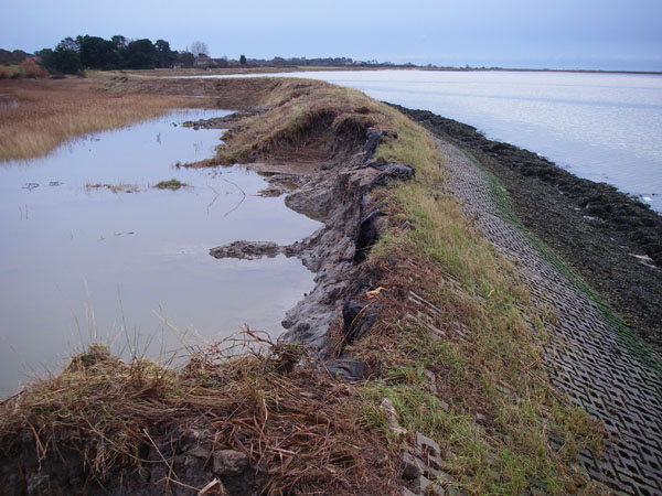
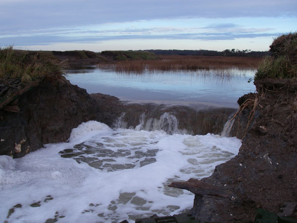
Images show surge damage post December 2013