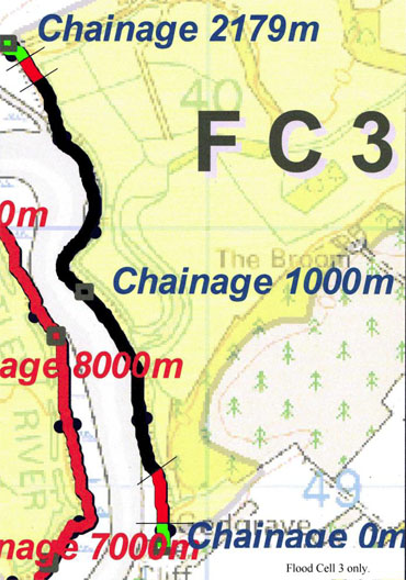
Flood Cell 3
Click the image above to view the flood cell 3 map with colour key
INTRODUCTION
The flood cell of 301 hectares is on the east side of the Butley River between Sudbourne Park and Gedgrave Hall and contains arable, semi and permanent wet grassland, deciduous woodland and some hedgerows. An interesting feature known as the Fleet remains from the time before the river wall was built around 1600 and provides a reed-filled freshwater lagoon surrounded by grazing marsh. The western boundary of the cell abuts the network of the Alde/Ore/Butley Estuaries, a designated SAC (Special Area of Conservation) and contains habitats of conservation concern (see the more detailed description at Appendix 1). Intertidal habitat in front of the defences is internationally designated. Wildlife habitats in floodplains behind the walls include ditches with reed buntings, little grebe and kingfisher, fields with hares, flight area of barn and short eared owls, range of birds including lapwing, egret, swans, varieties of gulls.
…………………………………………………….
UPGRADE DESIGN PLAN
The map above and the upgrade design document below detail the work we need to do.
To Download the full plan, please click the link below